
This is a diary of my Eclipse road trip in August 2017 from Las Vegas to Idaho and back to Las Vegas via many canyons, an eclipse and a visit to my friend Derek in Sedona, Arizona.
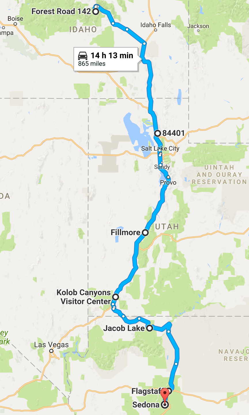
I arrived in Las Vegas on Thursday 17th, with plenty of time for the long drive north to Idaho to find a good spot for the eclipse on Monday the 21st. After that, I planned to drive to Sedona to meet Derek and then back to Las Vegas and home.
Thursday 17th – Manchester to Las Vegas to North Rim
I flew to Las Vegas from Manchester at 9:15am, partly to get a good price and also to have the chance the night before to enjoy the company of friends Stephen, Joy & Lily and dine with them and niece & nephew-in-law Sineád & Adam, recently moved to Manchester.
I turned up at a reasonable hour, but neglected to plan accommodation in the US, intending to sleep in the back of the SUV I hired. I was surprised that the check-in desk wanted to know where I was staying in the US, but quickly located a motel and told them that – nobody cared whether it was the truth! I was flying with Thomas Cook on a budget and didn’t expect a meal, but they did serve two and ‘tap water’. You could buy drinks.
As we flew over Canada and the northern mid western states and finally Wyoming and Utah, I could just about work out where we were using Galileo and its offline maps. I had downloaded them earlier in England to help me navigate when I feared that out in the midst of the American West I’d be without a network to access Google maps. The last part of the flight, coming in over Utah, Arizona and into Nevada was really beautiful, although looked scarily desertified and hot – we landed around midday Pacific Time.
Las Vegas McCarran airport has a shuttle bus to the hire car centre, some blocks away, and I hired my SUV and set off to a nearby Walmart to shop for cooking gear and food, water, beer and ice. I got the cheapest sleeping bag for $15 and a foam mattress cover to sleep on for $2 instead of the inflatable bed I’d planned. Other camping purchases include a saucepan, frying pan and propane stove. I got two gallons of water in plastic containers.
I headed out of La Vegas via the Strip on Las Vegas Boulevard and drove north on the interstate freeway I15, passing through the awesome Virgin River Canyon and paused in St George as evening descended, the first of many stops at Walmarts along the way to benefit from their free Wi-fi.

I drove on before finally stopping around 10:30pm along the state highway 89A, just before Jacob’s Lake. I was so tired, I could only drink a beer for supper.
I slept until 2:30am and woke to see the moon rise. With the clock in my head disrupted and feeling wakeful, I decided to drive on to North Rim to see the sun rise over the Grand Canyon. I had to refuel at Jacob Lake around 3am and arrived at the North Rim visitors’ centre around 4am in the black before dawn. I walked the path to Bright Angel Point in the dark and waited alone to watch the sun rise over the Grand Canyon.

Walking back, I realised how precipitous Bright Angel Point was, with sheer cliffs either side of the path and at one point a narrow bridge. Take a look at the link above and move the mouse around to shift your view! I suffer a little from fear of heights, and felt a little dizzy and out of breath on return to the car – later I learnt that it was most likely contributed to by the altitude, around 6,000 ft.
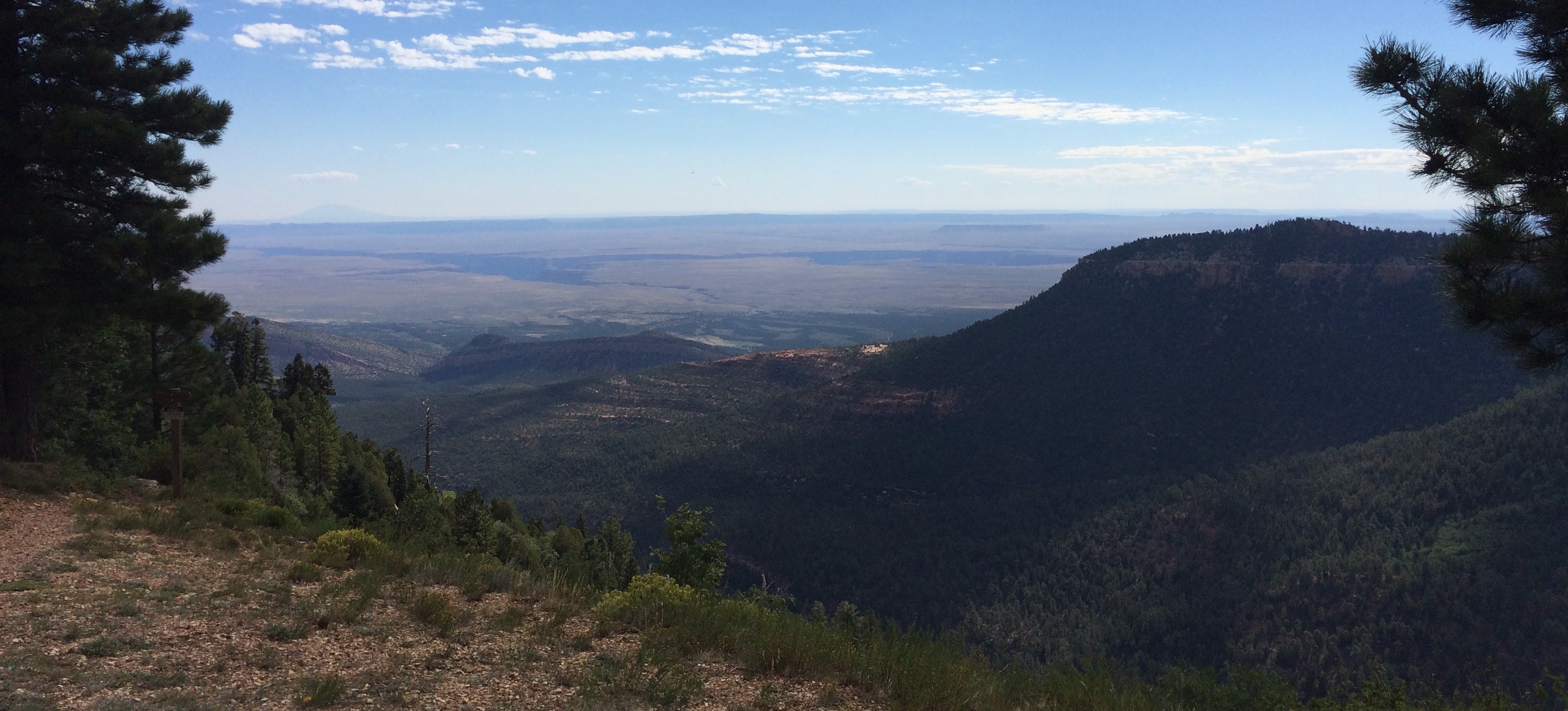
I drove back up the beautiful road, seeing wild bison, and then turned off to the East Rim overlook to cook breakfast in the forest. After eating, I took a short walk to see the East Rim view over the Grand Canyon: behind me, a delightful alpine scene of forest, meadow, deer and antelope; before me, a flat desert plain scarred by the Colorado River’s canyon cut-in deep, dark and devilish looking.
Friday 18th – North Rim to Ogden
Rested and well fed, I started the drive back through Jacob Lake and then Fredonia, Kanab and to visit Bryce Canyon.
Unlike the North Rim, Bryce Canyon was heaving with tourists and I parked and took the shuttle bus around to the viewpoints, again feeling the thinness of the air at around 8,000ft.
It was a most dramatic scene, demanding many photographs.
The road back from Bryce Canyon went through Red Canyon, remarkable by the standards of any other place, but overshadowed here:
Then north through Panguitch and across for the I15 to Salt Lake City and Ogden, reached in the dark, where I stopped, exhausted. I found a quiet place next to the freeway on an old main road at junction 341 on the I15 with West 31st Street and slept as long as I could.
Saturday 19th – Ogden to Forest Road 142, Mackay, Idaho
Waking again to the moon rise, now a slim crescent, I drove on.

Short of Pocatello, I took a turn to look for a breakfast spot and found myself in the South Mink Creek and stopped in the Slate Mountain trailhead car park to make breakfast and read a book for an hour.
Back on to the I15 and through Pocatello, I visited the Shoshone-Bannocks tribes’ museum at Fort Hall, notable for the abstract patterns on the Native American art:
Through Blackfoot, where I turned north west on the US26, I crossed the Snake River plain and passed Atomic City. This small village was built to house the scientists operating the many nuclear research establishments scattered widely over this desert plain as part of the Idaho National Laboratory. I visited the EBR-1 nuclear reactor museum near Arco which was the first Uraniam breeder reactor to generate electricity.
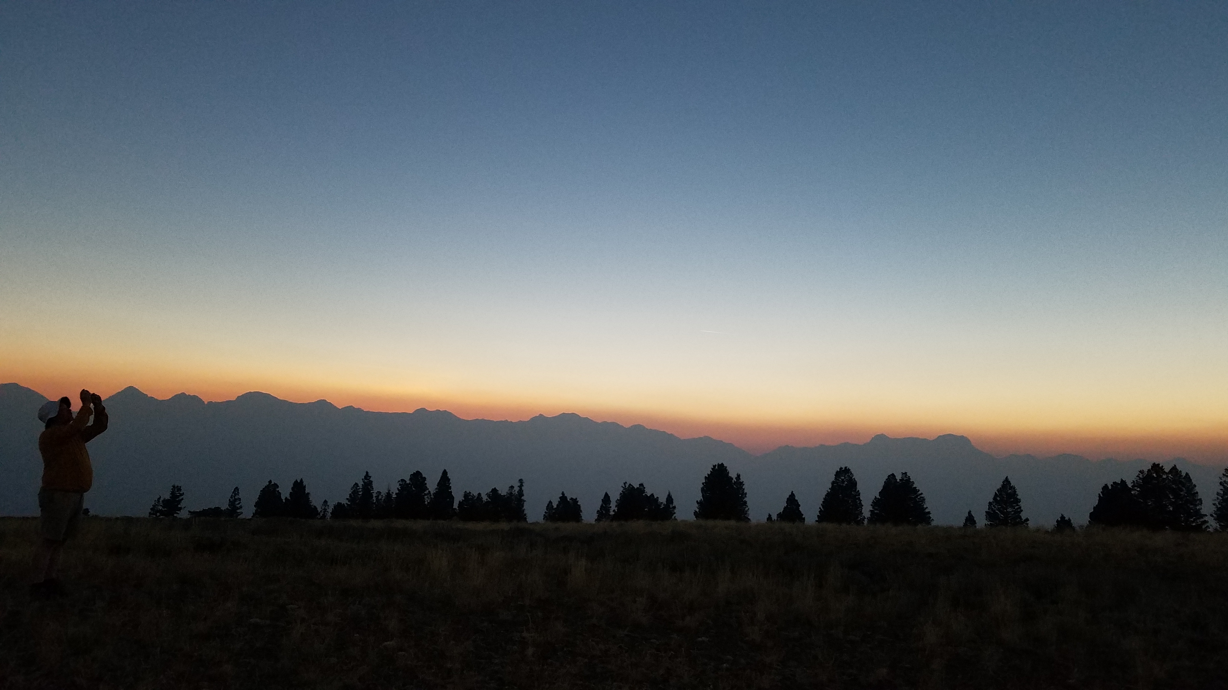
Filled up with petrol in Arco, I drove up past Mackay and its reservoir, an area I had scouted out on Google street view, but it was already pretty busy, so I drove on and turned off towards the hills on the west side of the valley. After seeing Ospreys with fish in their talons by the side of the road, I discovered a track and stopped to ask two men in camouflage clothing where it went. They turned out to be hunting with bow and arrow and advised me it would lead to the top and that there would be good camping spots there.
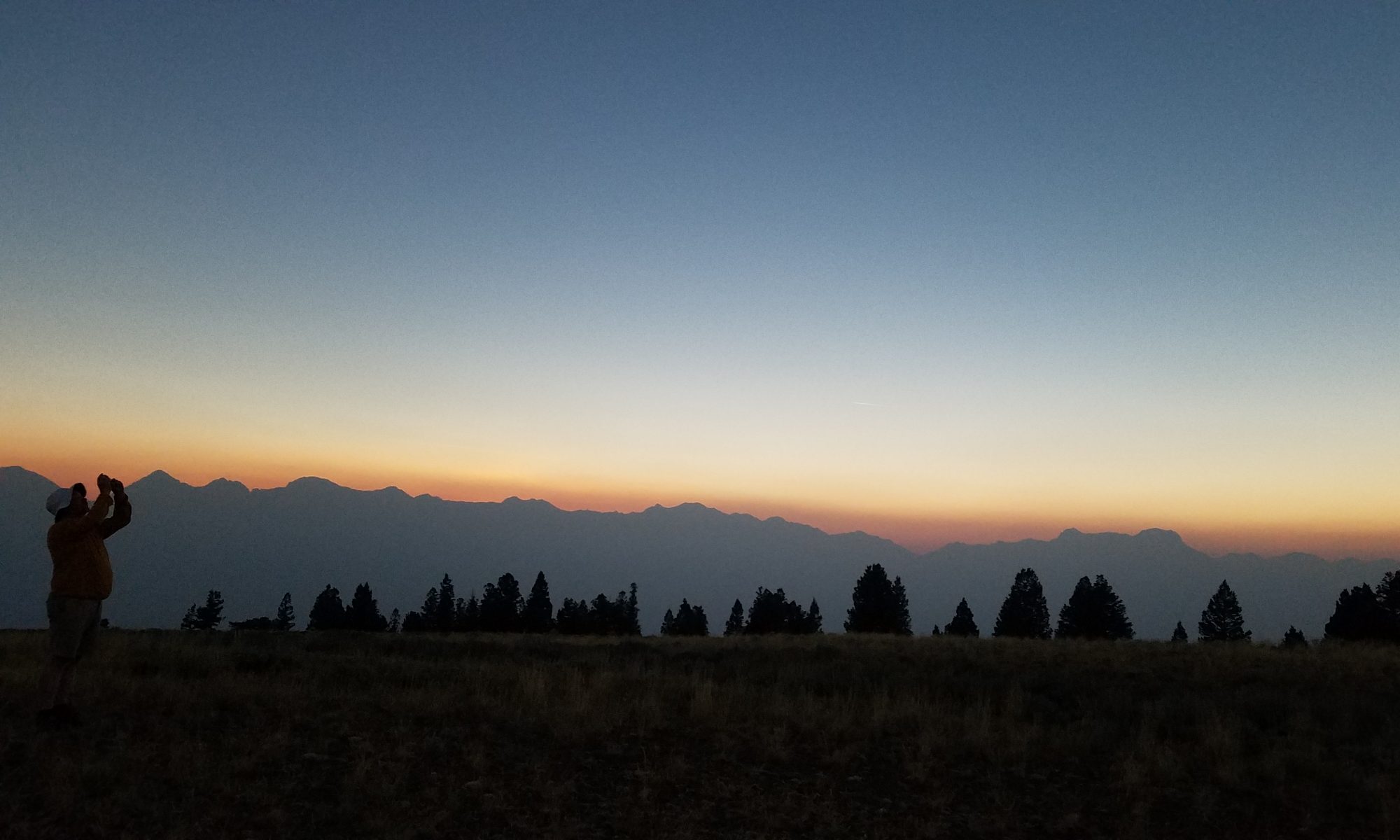
They were absolutely right – I drove up and found an excellent camp site in the shade of some pine trees and set about eating dinner. I had established my eclipse camping spot a day earlier than I had left time for, so felt really pleased to get some good rest and enjoyed the sunset illuminating the Lost River mountain range to the east across the valley, which included Borah Peak, the highest mountain in Idaho at 12,661 ft.
Sunday 20th – day of rest
After a good sleep, I still woke up early and watched the moon rise – so thin now as it neared the sun that it was almost invisible.
After breakfast, I walked along the road and then sat down to read Analogue Mountain, a gift from friend Doireann for Derek, but here I was with nothing to read and a day to fill!
For some reason a little later I discovered that the car wouldn’t start – the battery had run down. I blamed the sidelights.
After much worrying and thinking – I was a good way off the road and from the nearest habitation – I decided to make a sign to invite help. Every hour or so, a vehicle might pass on its way further in to the forest – there may have been as many as 12 people camping within a mile or two of me by the time of the eclipse.
The first encounter was with two quad bikers who couldn’t help, but promised to pass on the message.
Then a Mercedes van stopped and Dan Stempien got out, full of good cheer and had the jumper leads needed to start the car. Phew.
He travelled, lived and conducted his work in the summer months from his converted van. He was pleased to have found a mobile signal, with the help of an extra arial on the roof, which meant that he decided to camp next to me – welcome company.
A generous soul, he also gave me a spare pair of eclipse spectacles to watch with the next day.
Later, four other friendly eclipse watchers from Salt Lake City came along to say hi to us as their ‘neighbours’ and we enjoyed a discussion of stars and constellations over a drink.
Monday 21st – eclipse day
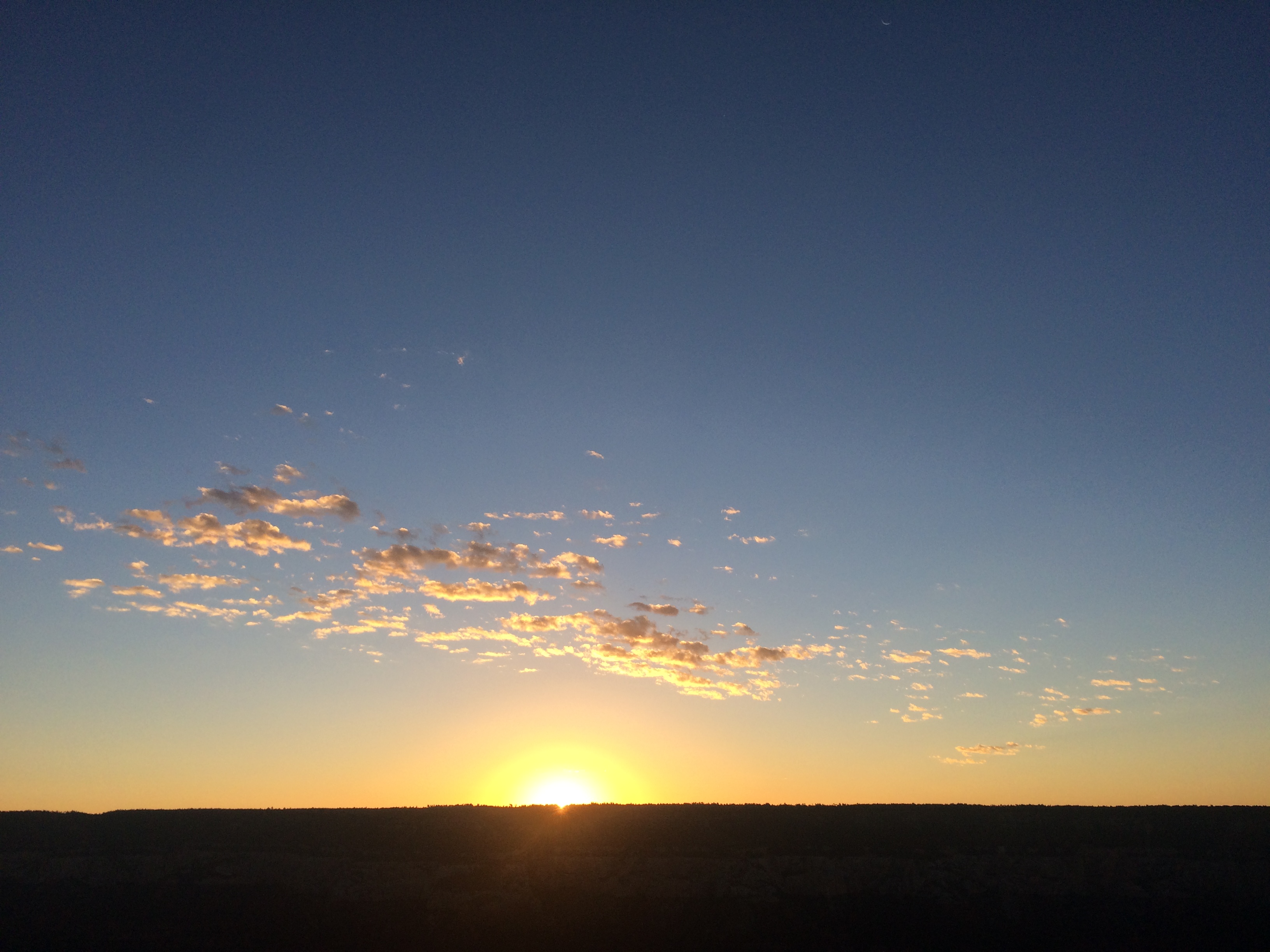
I was up early to watch the sun rise – no sign of the moon!
After breakfast, Dan and I watched the eclipse together and agreed it was both fantastic and emotional. The reduction in light and warmth as we watched the sun being ‘eaten’ was remarkable, perhaps exaggerated by the mountain top location. At totality, I was surprised that I could see the photosphere (atmosphere) of the sun with its coronal flares so comfortably and so brilliantly. The moment of the ‘diamond ring’ was phenomenal, a genuine jolt of adrenaline and cheers and whoops where audible from our neighbours, who were at least a mile away on another hilltop.
I set off for Sedona shortly later, finding modest queues as I exited the valley to Arco. Traffic was light until arriving in Blackfoot, where I mistook the northbound I15 slip road to Idaho Falls for the entrance to Walmart, so wasted time finding the next exit back to Blackfoot and to Walmart to pause and connect to the internet. Traffic on the I15 south was so bad that getting out of Blackfoot proved very slow and so I drove on side roads to avoid the masses. Eventually it picked up and I drove until nightfall to the same spot in Ogden, just North of Salt Lake City, that I had slept in on the way north.
I didn’t sleep long and woke in the night, deciding to drive on. This was premature, and I had to stop again just south of Salt Lake City to sleep some more.
Tuesday 22nd Salt Lake City to Sedona
I woke early and drove on, stopping to breakfast just off the I15 outside Fillmore, and then visited the statehouse museum in the city (town).

The museum had interesting original artefacts and explanations of the history of Mormon settlement and Native American relations in the early days. Particularly miserable to hear of the slave trading undertaken by a local chief, and his burial, which entailed the slaughtering of his two wives and his favourite horses to lie in his burial site with him. Also the staking of a young Indian child to district wolves from desecrating the grave. Shocking.
I then drove on a bit and stopped to visit the Kolob Canyons – remarkable rocks.
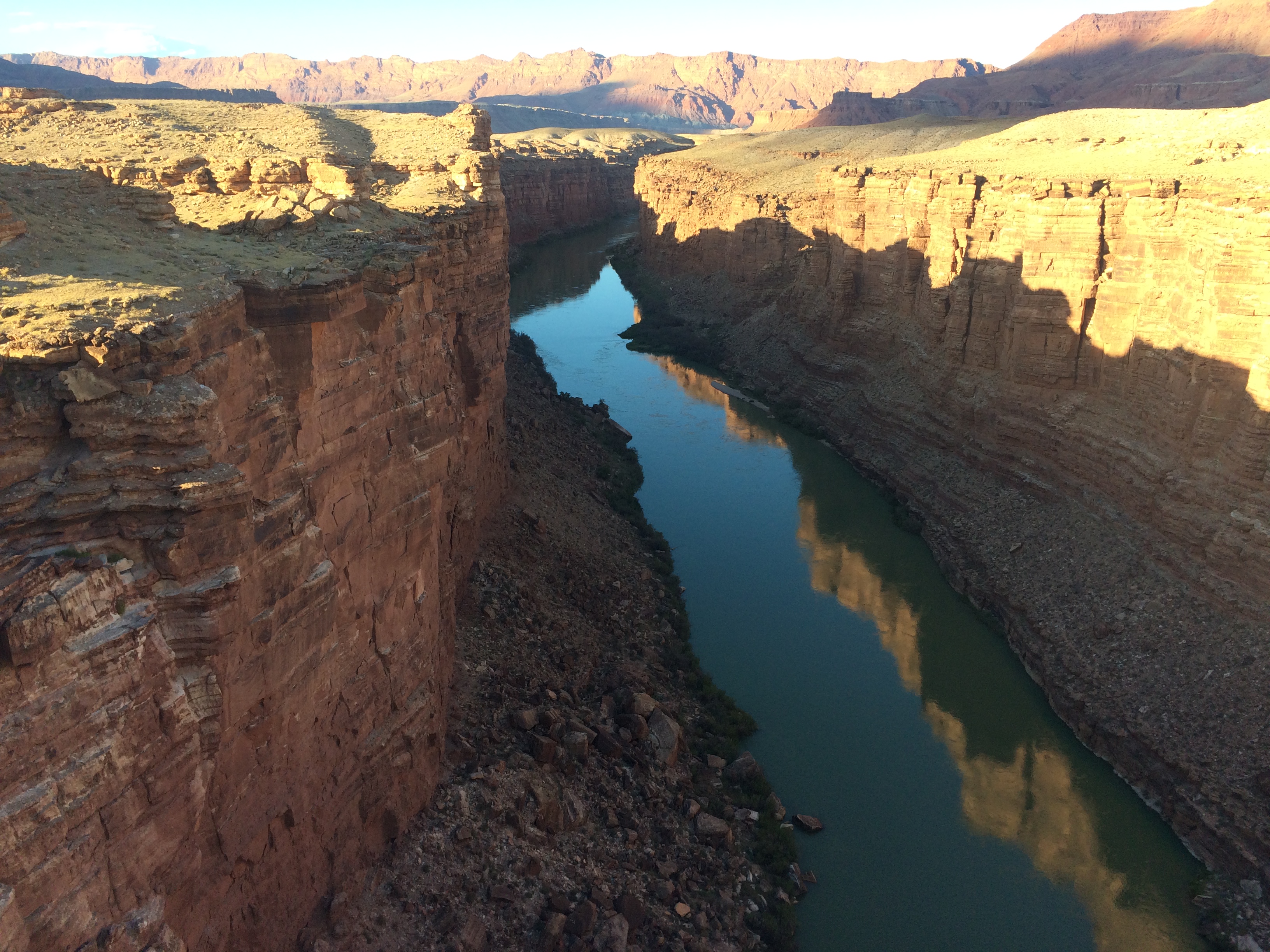
Next to Jacob Lake again and more petrol before descending the East Rim of the Grand Canyon and visiting Marble Canyon and the Navajo bridge as the sun was going down.
Then a long drive to Flagstaff, passing mile after mile after mile of Vermillion Cliffs and seeing many Native American homes and villages. In Flagstaff, I paused to connect with the Airbnb host for the place where I was to stay in Sedona, and tell Derek I was an hour away, before driving down to Sedona. Derek met me outside the house I rented and we eat takeaway and locally brewed beer and had a good talk before a much needed sleep.
Wednesday 23rd – Sedona
Derek came round in the morning and we went to buy a pass to visit sites in Sedona and breakfast in a nice cafe with traditional Mexican food.
We visit the ruined Sinagua dwellings in the Palatki Heritage Site and a grotto with cave paintings and a house built by a more recent settler who planted fruit trees in the canyon. We returned to drink in a lovely cafe and talk about micro worlds.
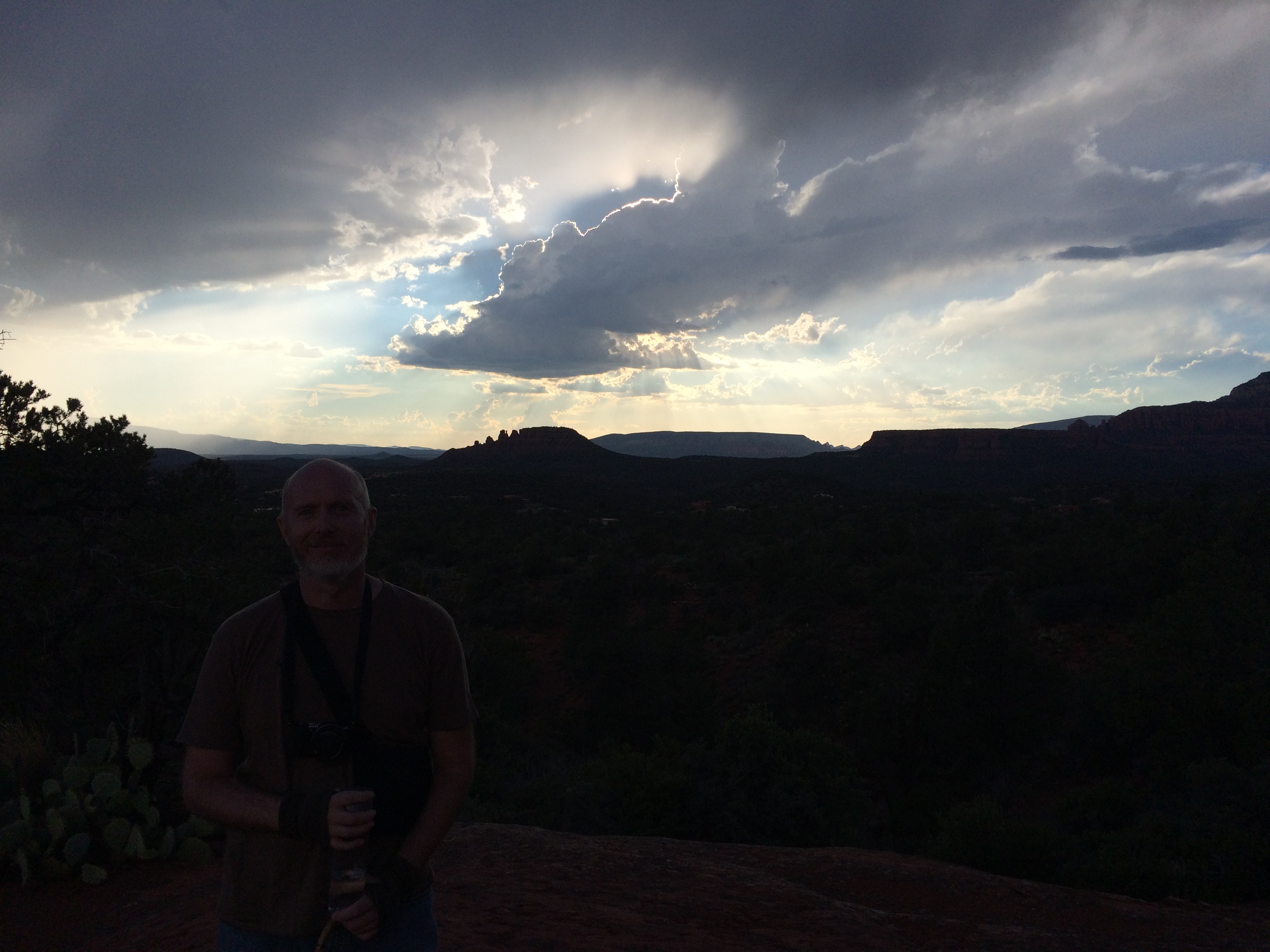
Later we visited Derek’s mum, talked butterflies and then went to sit on a rocky platform near Chimney Rock, not far from where I was staying, and enjoyed the sun set, talked about Derek’s condition and made a video for the Italian teachers in Urbino, who we were missing.
Finally, we enjoyed a delightful meal at the Mariposa (butterfly). A real pleasure to have such quality time with Derek.
Thursday 24th
Set off at 6:20 to drive to Las Vegas, with a brief visit to the Hoover Dam. Cool and rainy for the first time, flight home uneventful.
I drove 2,332 miles all told.